| |
Presidential
Candidate | Vice Presidential
Candidate | Political
Party | Popular Vote | Electoral Vote |
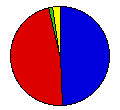
 | Ronald Reagan | George Bush | Republican |
654,192 |
48.75% | 9 |
 | James Carter | Walter Mondale | Democrat |
636,730 |
47.45% | 0 |
 | John Anderson | Patrick Lucey | Independent |
16,481 |
1.23% | 0 |
| John Rarick | Eileen Shearer | AL Conservative |
15,010 |
1.12% | 0 |
| Edward Clark | David Koch | Libertarian |
13,318 |
0.99% | 0 |
| Benjamin Bubar | Earl Dodge | AL Statesman |
1,743 |
0.13% | 0 |
| Gus Hall | Angela Davis | Communist |
1,629 |
0.12% | 0 |
| Clifton DeBerry | Matilde Zimmermann | Soc. Workers |
1,303 |
0.10% | 0 |
| David McReynolds | Diane Drufenbrock | Socialist |
1,006 |
0.07% | 0 |
| Barry Commoner | LaDonna Harris | Citizens |
517 |
0.04% | 0 |
 |
Map Key
| > 40% |
 |
 |
| > 50% |
 |
 |
| > 60% |
 |
 |
| > 70% |
 |
 |
| > 80% |
 |
|
| Turnout
 |  |  |
|
| Maps | 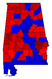 |  | | Pop. (m) | | Rep. (m) | | Dem. (m) | | Swg (m) | | Tnd (m) |
| |
| Demographic Data
| 1980 Population: | 3,894,025 | Enum. | 1980 Population Density: | 29.6 | persons/km2 | | 1970 Population: | 3,444,354 | Enum. | 1970 Population Density: | 26.2 | persons/km2 | | Total Electoral Vote: | 9 | | Electoral Vote Density: | 432,669 | persons/EV | | Land Area (2000): | 131,426 | km2 | Annual Pop Growth Rate: | 1.2 | % |
| Election Data and Statistics:
| Election Tools
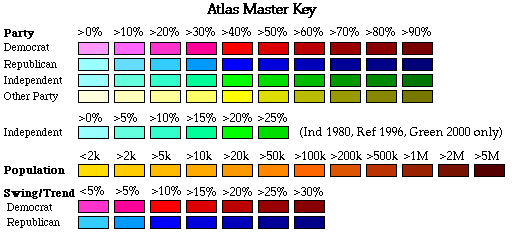
- Atlas Forum Image Code for Maps: County, Pop, Tnd, Swg
Data Sources:
- Source for Popular Vote data: Office of the Secretary of State State of Alabama. Elections Division, 1980 General Election President and Vice President of the United States (Montgomery, 0)
- Source for Population data: U.S. Census Bureau.
| Results for and Individual County:
|
|
| |


